
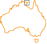
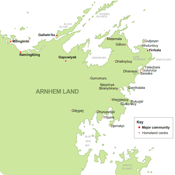
Map of eastern Arnhem Land
 There
are several major Yolŋu communities in eastern Arnhem Land, including:
Galiwin'ku, Gapuwiyak, Milingimbi, Ramingining, and Yirrkala.
There
are several major Yolŋu communities in eastern Arnhem Land, including:
Galiwin'ku, Gapuwiyak, Milingimbi, Ramingining, and Yirrkala.
There are also many homeland centres. These settlements have populations ranging from 20 to over a 100 people. The map below show the Laynha homelands centres of northeast Arnhemland.
A Yolŋu geography of eastern Arnhem land:
Saltwater Country
An estate of sea as well as land, containing sacred sites; created, named
and inhabited by Ancestral beings; existing in both the physical and spiritual
world.
Homeland
A Homeland is a territory or settlement owned by a Yolŋu clan or clans.
Today many Yolŋu live in, or regularly return
to, their clan homelands. See 'Clans
and kinship'.
Painting Saltwater Country
Yolŋu artists have inherited the right to paint their own country. Their
paintings show how the Ancestors travelled across the country, changing
the form of the landscape. Together Yolŋu paintings form a map of northeast
Arnhem Land. See 'Mapping
sea country'.
Seasons and seasonal indicators
In Yolŋu science we learn through observing the
seasons, we see the changes in time... we see changes in the weather patterns.
Through different seasons different food items are ready. Yolŋu don't just
hunt for everything at once but they go according to the different seasons.
Also Yolŋu sing about
these different seasons... they observe and see and learn. For generations
and generations these peoples have passed on this knowledge orally - it has
never been written down. Dr R. MarikaSee 'Observing
change'.